Our Team
Eliza Badiozamani
IME UNDERGRAD
Eliza Badiozamani is a third year Industrial Engineering student from Issaquah, Washington. She was in charge of the data curation efforts and created a visual rain model for a portion of the Ranch’s rain gauges, including creating a standardized system for documenting and implementing data. She loved incorporating skills learned at Cal Poly into a project that contributes towards climate and sustainability efforts..

Jonathan Ogden
CPE UNDERGRAD
Jonathan Ogden is a third year computer engineering major from Hemet California. He was tasked with exploring ArcGIS as a data repository and developing a proof of concept for an automated forestry inventory program. He enjoyed getting the right software that could one day be used to prevent wildfires.
Acknowledgements
We would like to thank the Johnson Family for sponsoring this project and therefor making it possible. We also want to thank the Swanton Pacific Ranch Data Collection team, namely Russ White and Grey Hayes for their assistance and feedback.
Our Project's Digital Poster
ABSTRACT
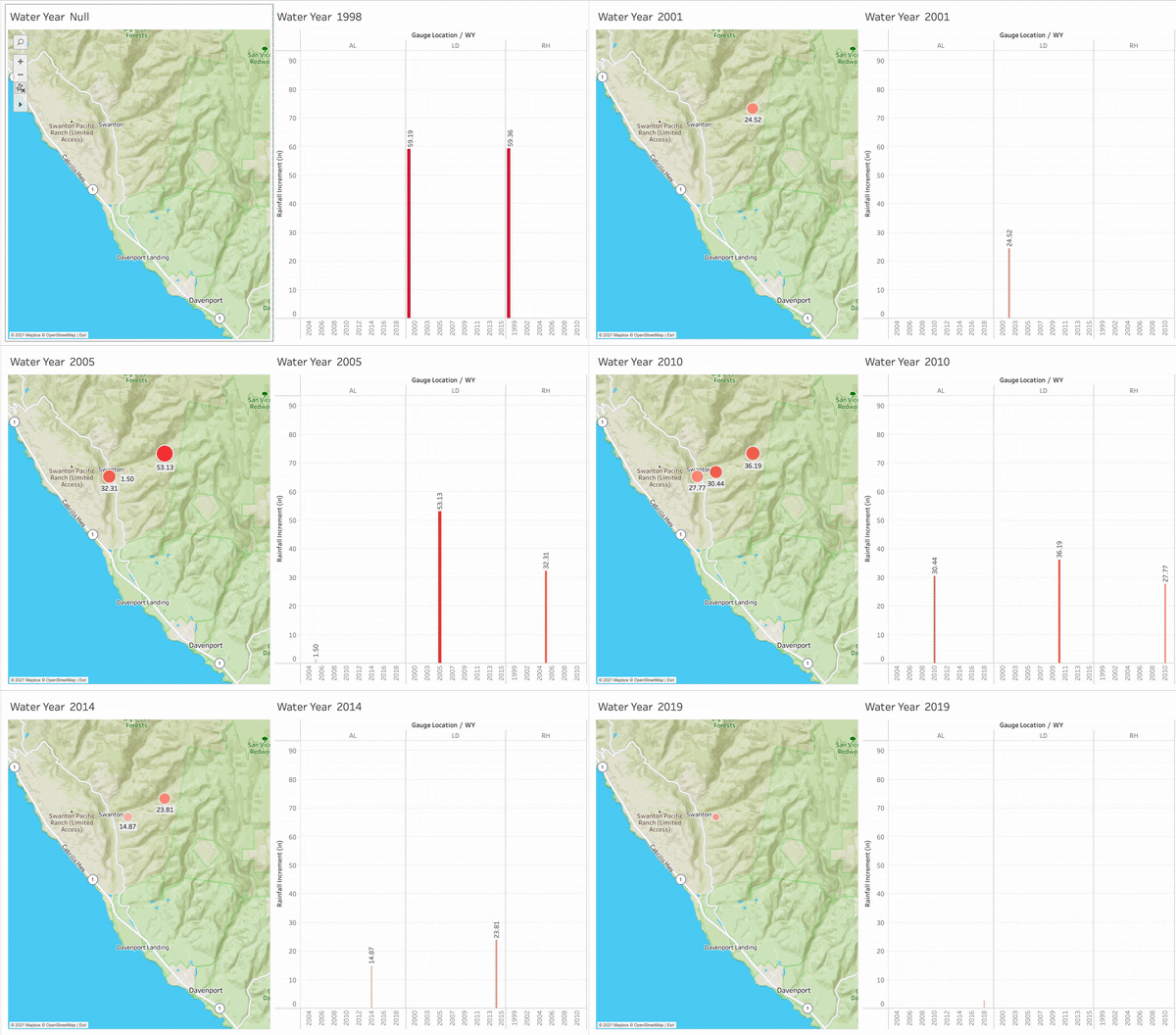
In this project we will begin data curation and start the modeling of Cal Poly’s Swanton Pacific Ranch. We will create master data sheets compiling past data collection efforts from the Ranch’s weather systems, and then model these in an interactive map of rainfall patterns by year, from 1998 to 2019. We will also create a Jupyter notebook to map tree crowns and count the number of trees as well as timber estimates before and after the August 2020 fire.
BACKGROUND
The Swanton Pacific Ranch is a 3,200 acre plot of land owned by Cal Poly that is located in the Santa Cruz County of California. Cal Poly has been using this ranch as a research and learning tool since 1993, when it was donated by alumni Al Smith, for the implementation of sustainable agriculture and harvesting techniques. The ranch has been valuable in upholding Cal Poly’s learn by doing motto, giving students hands on harvesting and research experience.
Overview
In August of 2020 the Swanton Pacific Ranch suffered severe fire damage from a lightning induced fire. Recovering from the damage is the focus of this project, with the long term goal of creating a predictive smart model of the ranch in the hopes that future fires can be stopped before they start. We started our efforts on sorting through many years of existing data that dates back to the 1990s so that they are usable in a model. Further curation of data will need to continue in order for all data to be usable. We then created visual models that will be turned predictive to monitor the rainfall.

CAL POLY COLLEGE OF ENGINEERING
Computer Science
Approach
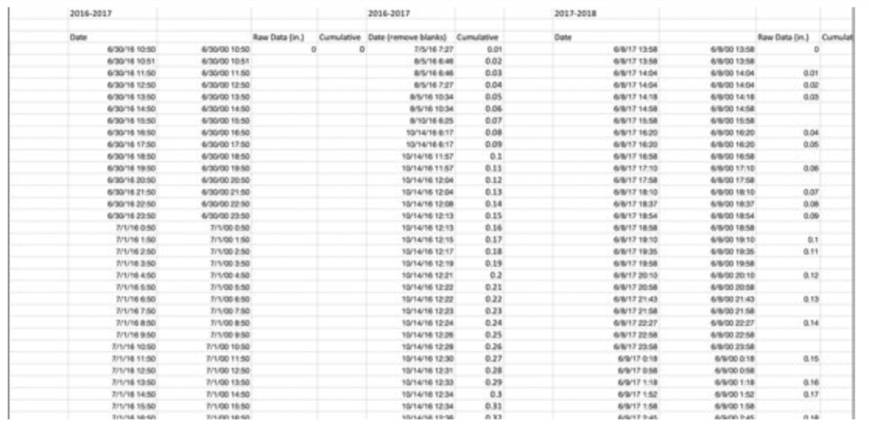
A standardized process was created for the use of curating rainfall data without troubleshooting or inconsistent techniques. A “data sheet” is then created for every data set spreadsheet. The HoboWare can be downloaded for this process and can be found online by a simple Google search.
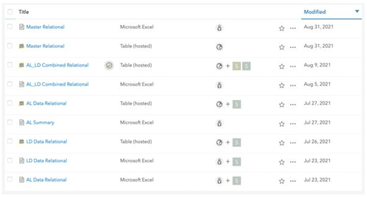
A full master spreadsheet was created by combing through the data sets gathered in the SPR Continuous Monitoring OneDrive folder. Below is a screenshot of a portion of this master data file. This data was then turned into a model that shows rainfall by year. We were only able to complete this process with three of the twelve gauge locations, however, detailed instructions were created for future students to curate the data accordingly and incorporate later.
ArcGIS Online as a data repository
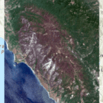
One challenge facing Swanton Pacific Ranch is finding a single location to host all the Data associated. As a proof of concept, it was decided to use the new ArcGIS online image processing sweet. To this end, two LiDAR images were added, Digital Surface Model (DSM), and Digital Surface Model (DSM) both taken in 2020. In addition, two satellite images were added, taken by the Sentinel-2 satellite. These images were each taken on June 18th and of the years 2020, and 2021.
PyCrow Tree Counting
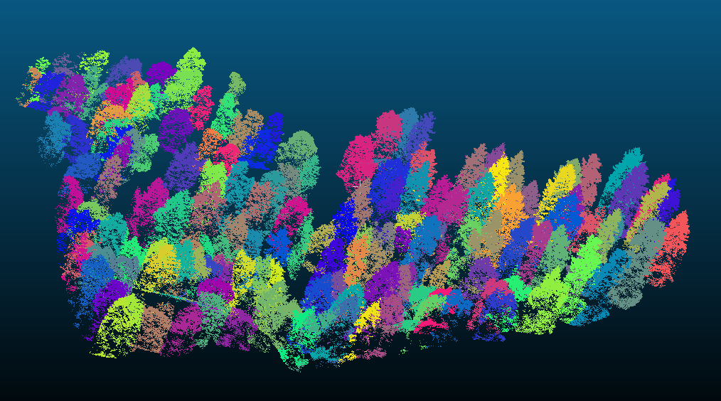
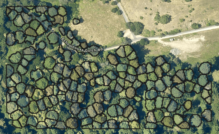
As part of an effort to gain a forestry inventory a program for counting and finding the tree crowns was created. To this end, a python-based ArcGIS online jupyter notebook has been created. This jupyter notebook uses LiDAR data in the form of a LAZ file taken from NOAA and saved onto an Amazon web services (AWS) server. This jupyter notebook implements the open-source data science tool PyCrown. This tool is used to find the Treetop locations, tree crowns, and an individual tree classification of the 3D point clouds, as well as the number of trees, and published the results to ArcGIS. in between the rear axle shafts of the prototype vehicle,allowing for power to be transmitted to the rear tires.
Continuation
ArcGIS online has sone to be an excellent data repository. However, it is not compatible with certain file types such as the LAZ files needed for the PyCrown project.
The PyCrow project could be expanded to be able to cover larger areas. This would mean dividing sections into chunks and processing them individually. One challenge would be how to deal with the trees along the borders. Additionally, the program could be modified to use LiDAR data taken at Swanton Pacific Ranch from other Cal Poly or student projects.

